Liste der Landschaftsschutzgebiete im Kreis Warendorf
Die Liste der Landschaftsschutzgebiete im Kreis Warendorf enthält die Landschaftsschutzgebiete des Kreises Warendorf in Nordrhein-Westfalen.
Liste
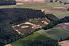
| Bild | Nummer | Bezeichnung des Gebietes | Fläche in Hektar | WDPA-ID | Koordinaten | Datum der Verordnung |
|---|---|---|---|---|---|---|
| LSG-3812-002 | LSG-Kattmannskamp | 395,7314 | 555552752 | Position52.0957.79369 | 1971 | |
| LSG-3912-0001 | LSG-Parklandschaft Brüskenheide | 530,7095 | 555552960 | Position52.06967.76682 | 2011 | |
| LSG-3912-0002 | LSG-Waldkomplex nördlich der Bever | 87,6792 | 555552961 | Position52.02687.80211 | 2011 | |
| LSG-3912-0003 | LSG-Waldgebiet Westerwald zwischen Aa und Saatgauer Bach | 135,7244 | 555552962 | Position52.07337.81973 | 2011 | |
| LSG-3912-0004 | LSG-Brüskenheide | 319,8002 | 555552963 | Position52.06047.74465 | 2008 | |
| LSG-3912-0005 | LSG-Westrupper Wiese | 44,4268 | 555552964 | Position52.04517.72547 | 2008 | |
| LSG-3912-0006 | LSG-Kulturlandschaft östlich Westbevern | 28,5346 | 555552965 | Position52.03067.79117 | 2008 | |
| LSG-3912-0007 | LSG-Kulturlandschaft Emsaue und Emsdünen südlich Westbevern Vadrup | 162,2601 | 555552966 | Position52.01897.74521 | 1974 | |
| LSG-3912-0008 | LSG-Beveraue mit Gut Haus Langen | 62,2627 | 555552967 | Position52.02137.77056 | 2008 | |
| LSG-3912-0009 | LSG-Kulturlandschaft zwischen NSG „In den Pöhlen“ und NSG „Emsaue bei Telgte“ | 13,6221 | 555552968 | Position52.01167.77159 | 1974 | |
| LSG-3912-001 | LSG-Emsaue in Telgte | 88,5876 | 555552969 | Position51.98567.79608 | 1974 | |
| LSG-3912-0010 | LSG-Landschaftsraum Waldfriedhof Lauheide bis Böhmerbach | 441,7493 | 555552970 | Position51.99197.7482 | 1971 | |
| LSG-3912-0011 | LSG-Landschaftsraum Harkampsheide und Fockenbrocksheide | 430,6067 | 555552971 | Position51.99627.84412 | 2008 | |
| LSG-3912-0012 | LSG-Gellenbach-Gertrudensee | 177,6928 | 555552972 | Position52.05957.71488 | 1982 | |
| LSG-3912-003 | LSG-Beveraue | 208,9209 | 555552975 | Position52.02937.8459 | 1974 | |
| LSG-3912-007 | LSG-Dünengebiet Klatenberge | 190,5064 | 555552976 | Position52.00057.78895 | 1971 | |
| LSG-3913-0001 | LSG-Am Vinnenberger Busch - Großer Dyk | 150,7623 | 555589418 | Position52.03677.95293 | 2004 | |
| LSG-3913-0002 | LSG-Bevertal | 246,7674 | 555552978 | Position52.02427.94727 | 2004 | |
| LSG-3913-0003 | LSG-Hülshorst / Schlangenbrink | 225,2549 | 555552979 | Position52.08177.85707 | 2011 | |
| LSG-3913-0004 | LSG-Wurzliche Heide / Loburg | 310,7135 | 555552980 | Position52.05217.89397 | 2011 | |
| LSG-3913-0005 | LSG-Hörster Heide | 91,8476 | 555552981 | Position52.01377.90068 | 2004 | |
| LSG-3913-0006 | LSG-Milter Mark | 101,8713 | 555552982 | Position52.01447.96963 | 2004 | |
| LSG-3913-0007 | LSG-Im Westvenn | 115,67 | 555552983 | Position52.02147.99024 | 2004 | |
| LSG-3913-0008 | LSG-Wälder in der Bever Mark | 157,3681 | 555552984 | Position52.03857.91671 | 2004 | |
 | LSG-3913-0009 | LSG-Landschaftsraum Schirlheide / Schultenheide | 673,8054 | 555552985 | Position52.01077.85194 | 2011 |
| LSG-3913-004 | LSG-Park Loburg | 115,5746 | 555552986 | Position52.03857.86849 | 1974 | |
| LSG-3914-005 | LSG-Subbern | 146,5057 | 555560825 | Position52.02648.03611 | 1974 | |
| LSG-3914-006 | LSG-Rippelbaum | 251,1491 | 555560826 | Position52.04138.07755 | 1974 | |
| LSG-3914-008 | LSG-Brook | 143,4967 | 555638527 | Position51.98898.06273 | 1988 | |
| LSG-4012-0001 | LSG-Waldgebiet Mengelingheide | 128,2543 | 555553186 | Position51.96337.7546 | 2008 | |
| LSG-4012-0002 | LSG-Kulturlandschaft entlang des Glanderbecker Baches | 50,9031 | 555553187 | Position51.95437.76332 | 2008 | |
| LSG-4012-0003 | LSG-Waldgebiet südlich der Mengelingheide | 20,5096 | 555553188 | Position51.94887.74825 | 2008 | |
| LSG-4012-0004 | LSG-Waldgebiet nördlich des Flugplatzes Münster-Telgte | 34,844 | 555553189 | Position51.9487.76975 | 2008 | |
| LSG-4012-0005 | LSG-Waldgebiet südwestlich des Flughafens Münster - Telgte | 51,6213 | 555553190 | Position51.94137.76774 | 2008 | |
| LSG-4012-0006 | LSG-Gehölz-Grünlandkomplex im Berdel | 38,6555 | 555553191 | Position51.93437.7792 | 2008 | |
| LSG-4012-0007 | LSG-Waldgebiet Brockenhagen und Glanderbecker Bach | 167,1532 | 555553192 | Position51.95627.80713 | 2008 | |
| LSG-4012-009 | LSG-Delsener Heide | 115,3394 | 555553194 | Position51.96867.80542 | 1971 | |
| LSG-4012-011 | LSG-Berdelheide, Püning | 316,1575 | 555553195 | Position51.91917.78065 | 1992 | |
| LSG-4012-015 | LSG-Werseniederung | 393,9276 | 555691024 | Position51.89577.71936 | 1971 | |
| LSG-4012-016 | LSG-Westliche Angelniederung | 201,0992 | 555553197 | Position51.90367.77567 | 1992 | |
| LSG-4012-017 | LSG-Dorffeld | 33,6198 | 555553198 | Position51.90577.81479 | 1992 | |
| LSG-4013-0001 | LSG-Einensche Mark | 598,8384 | 555553199 | Position51.99017.88854 | 2004 | |
| LSG-4013-0002 | LSG-Hesseltal | 457,4273 | 555553200 | Position51.98797.94038 | 1974 | |
| LSG-4013-0003 | LSG-Lange Wand - Kooks Heide | 303,9551 | 555553201 | Position51.97317.95935 | 1974 | |
| LSG-4013-0004 | LSG-Müssingener Wald - Am alten Münsterweg | 63,0949 | 555553202 | Position51.96347.91368 | 2004 | |
| LSG-4013-0005 | LSG-Emstal | 345,5075 | 555553203 | Position51.96477.94729 | 1974 | |
| LSG-4013-0006 | LSG-Waldkomplex bei Vechtrup | 8,4305 | 555553204 | Position51.98727.86785 | 2008 | |
| LSG-4013-0007 | LSG-Emsaue und Emsdünen zw. Telgte und Haus Lonn | 149,9471 | 555553205 | Position51.97827.84065 | 1974 | |
| LSG-4013-0008 | LSG-Maarbecke | 72,7141 | 555553206 | Position51.96047.84852 | 2008 | |
| LSG-4013-0009 | LSG-Kulturlandschaft Heidbusch-Maarbecke | 51,4369 | 555553207 | Position51.95257.84676 | 2008 | |
| LSG-4013-010 | LSG-Hesseltal | 120,3259 | 555560842 | Position51.99198.00942 | 1974 | |
| LSG-4013-012 | LSG-Müssingen | 5,4186 | 555691025 | Position51.95427.90062 | 1974 | |
| LSG-4013-013 | LSG-Hengen, Sundern | 145,3652 | 555691026 | Position51.91437.90778 | 1974 | |
| LSG-4013-018 | LSG-Mussenbach | 51,4156 | 555691027 | Position51.89367.91696 | 1974 | |
| LSG-4014-0001 | LSG-Kulturlandschaft nördlich der Emsniederung | 680,9151 | 555553212 | Position51.97018.07403 | 1999 | |
| LSG-4014-0002 | LSG-Emsaue | 138,1415 | 555553213 | Position51.96068.06607 | 1999 | |
| LSG-4014-0003 | LSG-Landratsbüsche / Vohrener Mark | 965,0789 | 555553214 | Position51.9248.05208 | 1999 | |
| LSG-4014-0004 | LSG-Dünenlandschaft und Waldgebiete südlich der Emsniederung | 368,7007 | 555553215 | Position51.95638.0913 | 1999 | |
| LSG-4014-0005 | LSG-Talbereiche des Axtbachs westlich von Beelen | 61,6808 | 555553216 | Position51.9438.07194 | 1974 | |
| LSG-4014-0006 | LSG-Axtbachniederung in Beelen | 19,817 | 555553217 | Position51.93038.11366 | 1974 | |
| LSG-4014-0007 | LSG-Bauerschaft Dackmar südlich der Hessel | 213,2755 | 555553218 | Position51.99318.09192 | 1988 | |
| LSG-4014-0008 | LSG-Axtbachniederung / Bauerschaft Öster | 324,6928 | 555553219 | Position51.93218.14884 | 1999 | |
| LSG-4014-0009 | LSG-Beelener Mark mit Beilbachniederung / Hemfeld | 260,0465 | 555553220 | Position51.9058.14048 | 1999 | |
| LSG-4111-019 | LSG-Hohe Ward | 302,7463 | 555691034 | Position51.87377.6829 | 1971 | |
| LSG-4111-020 | LSG-Davert | 326,8362 | 555691035 | Position51.84977.64982 | 1971 | |
| LSG-4112-021 | LSG-Wietkamp - Feldbusch | 95,517 | 555553460 | Position51.88787.80532 | 1992 | |
| LSG-4112-022 | LSG-Östliche Angelniederung | 94,8018 | 555553461 | Position51.89427.82092 | 1992 | |
| LSG-4112-023 | LSG-Kleibusch | 35,0682 | 555553462 | Position51.87837.82409 | 1992 | |
| LSG-4112-030 | LSG-Averdung | 410,6277 | 555553463 | Position51.827.77726 | 1986 | |
| LSG-4112-046 | LSG-Gegliederter Agrarraum bei Hof „Potthast“ nordwestlich Ahlen | 86,0519 | 555553464 | Position51.80757.79791 | 1994 | |
| LSG-4112-047 | LSG-Borbein nördlich der Werse | 377,3498 | 555553465 | Position51.7947.85143 | 1994 | |
| LSG-4113-001 | LSG-Ächterberg nordwestlich Neubeckum | 172,0041 | 555553466 | Position51.80567.99592 | 1997 | |
| LSG-4113-024 | LSG-Finkenberg | 377,2001 | 555691036 | Position51.87068.00967 | 1974 | |
| LSG-4113-048 | LSG-Parklandschaft im Bereich Halene | 197,7099 | 555553468 | Position51.79727.89171 | 1994 | |
| LSG-4113-049 | LSG-Angelfeld westlich Tönnishäuschen | 98,2054 | 555553469 | Position51.82587.90768 | 1994 | |
| LSG-4113-050 | LSG-Sundern, Haus Vorhelm | 200,3042 | 555553470 | Position51.81837.93599 | 1994 | |
| LSG-4113-051 | LSG-Torcksholt, Hellbachaue | 213,02 | 555553471 | Position51.80197.97184 | 1994 | |
| LSG-4113-052 | LSG-Parklandschaft südlich von Vorhelm | 357,7892 | 555553472 | Position51.79647.92544 | 1994 | |
| LSG-4114-004 | LSG-Geistkamp östlich Neubeckum | 6,4071 | 555553473 | Position51.80118.04975 | 1997 | |
| LSG-4114-025 | LSG-Hohes Kreuz, Vornholz, Geisterbach | 447,2747 | 555691037 | Position51.87148.09637 | 1974 | |
| LSG-4114-026 | LSG-Vintrop-Ost | 3,1733 | 555691038 | Position51.84518.09838 | 1974 | |
| LSG-4114-027 | LSG-Köntrup | 1,5509 | 555691039 | Position51.8518.12524 | 1974 | |
| LSG-4114-028 | LSG-Letter Geist | 6,2788 | 555691040 | Position51.85868.13656 | 1974 | |
| LSG-4114-029 | LSG-Geisterholz | 137,2551 | 555691041 | Position51.8358.09994 | 1966 | |
| LSG-4214-005 | LSG-Dörberg | 205,8243 | 555553707 | Position51.78848.09878 | 1997 | |
| LSG-4214-006 | LSG-Steinbruch Honerberg | 21,6409 | 555553708 | Position51.75238.06639 | 1997 | |
| LSG-4214-007 | LSG-Kollenbach | 35,6274 | 555553709 | Position51.7678.07147 | 1997 | |
| LSG-4214-034 | LSG-Diestedder Berg | 623,6188 | 555553710 | Position51.75238.1441 | 1991 | |
| LSG-4214-036 | LSG-Önkhaus-Berg | 110,7429 | 555553711 | Position51.73258.13092 | 1991 | |
| LSG-4215-035 | LSG-Höhenrücken bei Basel | 643,5666 | 555553712 | Position51.75848.21093 | 1991 | |
| LSG-4215-037 | LSG-Sandbreede-Schoppenkamp (Bergwiesenbach) | 50,2172 | 555553713 | Position51.72268.20566 | 1991 | |
| LSG-4215-038 | LSG-Hermisholz | 140,6977 | 555553714 | Position51.70638.21988 | 1991 | |
| LSG-4215-039 | LSG-Liesborner Holz - Sengers Busch | 196,2113 | 555553715 | Position51.7158.24497 | 1991 | |
| LSG-4215-041 | LSG-Eickenpfahlbusch | 87,0471 | 555553716 | Position51.70058.25745 | 1991 | |
| LSG-4215-042 | LSG-Osthusen-Boom | 397,3359 | 555553717 | Position51.69748.28584 | 1991 | |
| LSG-4212-032 | LSG-Mersch | 455,4017 | 555553690 | Position51.76867.72198 | 1986 | |
| LSG-4212-055 | LSG-Östricher Wald, Parklandschaft westl. Ahlen | 451,8538 | 555553691 | Position51.75067.84645 | 1994 | |
| LSG-4213-001 | LSG-Düppenkamp in Hinteler | 26,0404 | 555553692 | Position51.78547.98856 | 1997 | |
| LSG-4213-002 | LSG-Hinteler | 226,7799 | 555553693 | Position51.77077.98457 | 1997 | |
| LSG-4213-003 | LSG-Goldsteinbusch - Elker | 266,3352 | 555553694 | Position51.74297.97013 | 1997 | |
| LSG-4213-004 | LSG-Goldberg bei Holtmar | 111,4201 | 555553695 | Position51.74528.00276 | 1997 | |
| LSG-4213-006 | LSG-Beckumer Berge | 2120,72 | 555553696 | Position51.73578.07603 | 1997 | |
| LSG-4213-053 | LSG-Stadtwald Langst | 96,6819 | 555553698 | Position51.77967.92523 | 1994 | |
| LSG-4213-054 | LSG-Vinckewald, Düppe | 157,2733 | 555553699 | Position51.78497.97267 | 1994 | |
| LSG-4213-056 | LSG-Gegliederter Agrarraum bei Haus Pustekrey | 107,6749 | 555553700 | Position51.74567.94452 | 1994 | |
| LSG-4213-057 | LSG-Parklandschaft um Dolberg | 756,0755 | 555553701 | Position51.71997.9264 | 1994 | |
| LSG-4213-058 | LSG-Lippeniederterrasse | 61,178 | 555553702 | Position51.70577.9202 | 1994 | |
| LSG-4214-001 | LSG-Friedrichshorster Bruch | 116,4027 | 555553703 | Position51.78668.01798 | 1997 | |
| LSG-4214-002 | LSG-Hinterste Holt bei Roland | 63,8138 | 555553704 | Position51.77718.00689 | 1997 | |
| LSG-4214-003 | LSG-Hellbach | 74,0519 | 555553705 | Position51.79068.05135 | 1997 | |
| LSG-4214-004 | LSG-Günksberg-Eixternberg | 249,7376 | 555553706 | Position51.80348.07401 | 1997 | |
| LSG-4315-043 | LSG-Linsebach | 147,7704 | 555553940 | Position51.67158.21381 | 1991 | |
| LSG-4315-044 | LSG-Baage-Hausbusch | 392,9388 | 555553941 | Position51.67298.2508 | 1991 | |
| LSG-4315-045 | LSG-Lippeniederung | 143,835 | 555553942 | Position51.66948.25623 | 1991 |
Siehe auch
Weblinks
Commons: Landschaftsschutzgebiete im Kreis Warendorf – Sammlung von Bildern, Videos und Audiodateien
- Datenquelle, Datei CDDA_v12_csv.zip, Stand Oktober 2014.
- Karte mit allen Koordinaten:
- OSM
- WikiMap

Städteregion Aachen | Bielefeld | Bochum | Bonn | Borken | Bottrop | Coesfeld | Dortmund | Duisburg | Düren | Düsseldorf | Ennepe-Ruhr-Kreis | Essen | Euskirchen | Gelsenkirchen | Gütersloh | Hagen | Hamm | Heinsberg | Herford | Herne | Hochsauerlandkreis | Höxter | Kleve | Köln | Krefeld | Leverkusen | Lippe | Märkischer Kreis | Mettmann | Minden-Lübbecke | Mönchengladbach | Mülheim an der Ruhr | Münster | Oberbergischer Kreis | Oberhausen | Olpe | Paderborn | Recklinghausen | Remscheid | Rhein-Erft-Kreis | Rheinisch-Bergischer Kreis | Rhein-Kreis Neuss | Rhein-Sieg-Kreis | Siegen-Wittgenstein | Soest | Solingen | Steinfurt | Unna | Viersen | Warendorf | Wesel | Wuppertal


 Liste_der_Landschaftsschutzgebiete_im_Kreis_Warendorf