Ōrākei Local Board
Local board of Ōrākei in Auckland, New Zealand
Ōrākei Local Board Te Poari ā-Rohe o Ōrākei | |
|---|---|
Local board of Ōrākei | |
 Ōrākei Local Board office in Meadowbank | |
 | |
| Country | New Zealand |
| Region | Auckland |
| Territorial authority | Auckland Council |
| Ward | Ōrākei ward |
| Legislated | 2010 |
| Area [1] | |
| • Land | 32.35 km2 (12.49 sq mi) |
| Population (June 2023)[2] | |
| • Total | 86,200 |
Local Board Members | |
|---|---|
| Leadership | |
Chairperson | Scott Milne JP, C & R |
Deputy chairperson | Sarah Powrie, C & R |
| Structure | |
| Seats | 7 |
Political groups | Communities and Residents (7) |
Length of term | 3 years |
| Elections | |
Last election | 2022 |
Next election | 2025 |
| Meeting place | |
| 25 St Johns Road, Meadowbank | |
The Ōrākei Local Board is one of the 21 local boards of Auckland Council. It is coterminous with the Ōrākei ward. It was chaired in its first two terms by local politician Desley Simpson following the 2010 and 2013 elections. In the 2016 elections, Simpson stood for and won the Orakei ward councillor seat on Auckland Council. Colin Davis took her place as Chair.
Governance
The board consists of 7 members who were elected in the 2022 local elections.
Demographics
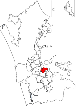
Ōrākei Local Board Area covers 32.35 km2 (12.49 sq mi)[1] and had an estimated population of 86,200 as of June 2023,[2] with a population density of 2,665 people per km2.
2022 local elections
Between September and October 2022, the 2022 Auckland local elections took place. The board members elected for the 2022-2025 term were:[3]
- Troy Churton, C&R - Communities & Residents (18,961 votes)
- David Wong, C&R - Communities & Residents (18,488 votes)
- Scott Milne, C&R - Communities & Residents (18,422 votes)
- Penny Tucker, C&R - Communities & Residents (18,251 votes)
- Sarah Powrie, C&R - Communities & Residents (17,501 votes)
- Margaret Voyce, C&R - Communities & Residents (16,352 votes)
- Angus Mcphee, C&R - Communities & Residents (16,119 votes)
References
- ^ a b "ArcGIS Web Application". statsnz.maps.arcgis.com. Retrieved 25 February 2022.
- ^ a b "Subnational population estimates (RC, SA2), by age and sex, at 30 June 1996-2023 (2023 boundaries)". Statistics New Zealand. Retrieved 25 October 2023. (regional councils); "Subnational population estimates (TA, SA2), by age and sex, at 30 June 1996-2023 (2023 boundaries)". Statistics New Zealand. Retrieved 25 October 2023. (territorial authorities); "Subnational population estimates (urban rural), by age and sex, at 30 June 1996-2023 (2023 boundaries)". Statistics New Zealand. Retrieved 25 October 2023. (urban areas)
- ^ "Ōrākei Local Board – confirmed". Auckland Council. Retrieved 4 April 2023.
External links
- Ōrākei Local Board
- v
- t
- e
Local Boards
Local Subdivisions
| Albany Ward |
| ||||||
|---|---|---|---|---|---|---|---|
| Albert-Eden-Puketāpapa Ward |
| ||||||
| Franklin Ward |
| ||||||
| Howick Ward |
| ||||||
| Manukau Ward |
| ||||||
| Manurewa-Papakura Ward |
| ||||||
| Maungakiekie-Tāmaki Ward |
| ||||||
| North Shore Ward |
| ||||||
| Ōrākei Ward |
| ||||||
| Rodney Ward |
| ||||||
| Waitākere Ward |
| ||||||
| Waitematā and Gulf Ward |
| ||||||
| Whau Ward |
|
- Ambury
- Ātiu Creek
- Auckland Botanic Gardens
- Āwhitu
- Duder
- Glenfern Sanctuary
- Hunua Ranges
- Long Bay
- Mahurangi
- Motukorea Browns Island
- Muriwai
- Mutukaroa / Hamlins Hill
- Ōmana
- Orere Point
- Pākiri
- Scandrett
- Shakespear
- Tāpapakanga
- Tāwharanui
- Tawhitokino
- Te Ārai
- Te Muri
- Te Rau Pūriri
- Waharau
- Waitākere Ranges
- Waitawa
- Wenderholm
- Whakanewha
- Whakatīwai
Authority control databases | |
|---|---|
| International |
|
| National |
|
36°52′35.31″S 174°49′36.11″E / 36.8764750°S 174.8266972°E / -36.8764750; 174.8266972


