Abava Parish
Parish in Latvia
You can help expand this article with text translated from the corresponding article in Latvian. (January 2024) Click [show] for important translation instructions.
- View a machine-translated version of the Latvian article.
- Machine translation, like DeepL or Google Translate, is a useful starting point for translations, but translators must revise errors as necessary and confirm that the translation is accurate, rather than simply copy-pasting machine-translated text into the English Wikipedia.
- Do not translate text that appears unreliable or low-quality. If possible, verify the text with references provided in the foreign-language article.
- You must provide copyright attribution in the edit summary accompanying your translation by providing an interlanguage link to the source of your translation. A model attribution edit summary is
Content in this edit is translated from the existing Latvian Wikipedia article at [[:lv:Abavas pagasts]]; see its history for attribution. - You may also add the template
{{Translated|lv|Abavas pagasts}}to the talk page. - For more guidance, see Wikipedia:Translation.
Parish of Latvia

Coat of arms
57°03′47″N 22°30′54″E / 57.0631°N 22.5151°E / 57.0631; 22.5151 
[1][2]
(1 January 2024)[3]

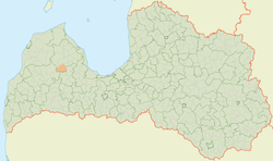
Abava parish (Latvian: Abavas pagasts) is an administrative unit of Talsi Municipality, Latvia.[4][5]
References
- ^ "Reģionu, novadu, pilsētu un pagastu kopējā un sauszemes platība gada sākumā". Central Statistical Bureau of Latvia. Retrieved 31 July 2024.
- ^ "Reģionu, novadu, pilsētu un pagastu kopējā un sauszemes platība gada sākumā". Central Statistical Bureau of Latvia. Retrieved 31 July 2024.
- ^ "Iedzīvotāju skaits pēc tautības reģionos, pilsētās, novados, pagastos, apkaimēs un blīvi apdzīvotās teritorijās gada sākumā (pēc administratīvi teritoriālās reformas 2021. gadā)". Central Statistical Bureau of Latvia. Retrieved 19 June 2024.
- ^ Latvijas PSR mazā enciklopēdija, vol 1. Rīga: Izdevniecība "Zinātne".
- ^ Latvijas pagasti. Enciklopēdija. Rīga: A/S Preses nams. 2001—2002. ISBN 9984004120
- v
- t
- e
Cities, Municipalities and Parishes of the defunct Talsi District
- Stende
- Talsi
- Valdemārpils
- Sabile
| Authority control databases: National |
|
|---|
57°04′N 22°34′E / 57.06°N 22.56°E / 57.06; 22.56
 | This Courland location article is a stub. You can help Wikipedia by expanding it. |
- v
- t
- e


 Abava_parish