Batočina
Town and municipality in Šumadija and Western Serbia, Serbia
Batočina Баточина (Serbian) | |
|---|---|
Town and municipality | |
 | |
 Coat of arms | |
 Location of the municipality of Batočina within Serbia | |
| Coordinates: 44°09′N 21°05′E / 44.150°N 21.083°E / 44.150; 21.083 | |
| Country |  Serbia Serbia |
| Region | Šumadija and Western Serbia |
| District | Šumadija |
| Settlements | 11 |
| Government | |
| • Mayor | Dejan Aranđelović (SNS) |
| Area [1] | |
| • Municipality | 136 km2 (53 sq mi) |
| Elevation | 111 m (364 ft) |
| Population (2011 census)[2] | |
| • Town | 5,804 |
| • Municipality | 11,760 |
| Time zone | UTC+1 (CET) |
| • Summer (DST) | UTC+2 (CEST) |
| Postal code | 34227 |
| Area code | +381(0)34 |
| Car plates | KG |
| Website | www |
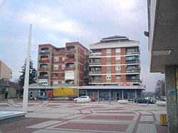
Batočina (Serbian: Баточина, pronounced [bâtɔtʃina]) is a town and municipality located in the Šumadija District of central Serbia. According to 2011 census, the population of the town is 5,804, while population of the municipality is 11,760.[2]
Settlements
Aside from the town of Batočina, the municipality includes the following settlements:
|
|
Demographics
| Year | Pop. | ±% p.a. |
|---|---|---|
| 1948 | 12,003 | — |
| 1953 | 12,309 | +0.50% |
| 1961 | 12,455 | +0.15% |
| 1971 | 12,459 | +0.00% |
| 1981 | 13,452 | +0.77% |
| 1991 | 13,459 | +0.01% |
| 2002 | 12,220 | −0.87% |
| 2011 | 11,760 | −0.43% |
| Source: [3] | ||
Economy
The following table gives a preview of total number of employed people per their core activity (as of 2017):[4]
| Activity | Total |
|---|---|
| Agriculture, forestry and fishing | 3 |
| Mining | 40 |
| Processing industry | 981 |
| Distribution of power, gas and water | 27 |
| Distribution of water and water waste management | 94 |
| Construction | 45 |
| Wholesale and retail, repair | 414 |
| Traffic, storage and communication | 81 |
| Hotels and restaurants | 33 |
| Media and telecommunications | 27 |
| Finance and insurance | 19 |
| Property stock and charter | 5 |
| Professional, scientific, innovative and technical activities | 30 |
| Administrative and other services | 37 |
| Administration and social assurance | 117 |
| Education | 156 |
| Healthcare and social work | 105 |
| Art, leisure and recreation | 24 |
| Other services | 28 |
| Total | 2,266 |
References
- ^ "Municipalities of Serbia, 2006". Statistical Office of Serbia. Retrieved 2010-11-28.
- ^ a b "2011 Census of Population, Households and Dwellings in the Republic of Serbia: Comparative Overview of the Number of Population in 1948, 1953, 1961, 1971, 1981, 1991, 2002 and 2011, Data by settlements" (PDF). Statistical Office of Republic Of Serbia, Belgrade. 2014. ISBN 978-86-6161-109-4. Retrieved 2014-06-27.
- ^ "2011 Census of Population, Households and Dwellings in the Republic of Serbia" (PDF). stat.gov.rs. Statistical Office of the Republic of Serbia. Archived from the original (PDF) on 14 July 2014. Retrieved 11 January 2017.
- ^ "ОПШТИНЕ И РЕГИОНИ У РЕПУБЛИЦИ СРБИЈИ, 2018" (PDF). stat.gov.rs (in Serbian). Statistical Office of the Republic of Serbia. Retrieved 16 March 2019.
External links
Wikimedia Commons has media related to Batočina.
- Official website
- v
- t
- e
Cities, towns and villages in the Šumadija District
- Adžine Livade
- Baljkovac
- Beloševac
- Botunje
- Bukorovac
- Velika Sugubina
- Velike Pčelice
- Veliki Šenj
- Vinjište
- Vlakča
- Goločelo
- Gornja Sabanta
- Gornje Grbice
- Gornje Jarušice
- Gornje Komarice
- Grošnica
- Desimirovac
- Divostin
- Dobrača
- Donja Sabanta
- Donje Grbice
- Donje Komarice
- Dragobraća
- Drača
- Drenovac
- Dulene
- Đuriselo
- Erdeč
- Jabučje
- Jovanovac
- Kamenica
- Korman
- Kotraža
- Kutlovo
- Lužnice
- Ljubičevac
- Mala Vrbica
- Mali Šenj
- Maršić
- Masloševo
- Mironić
- Novi Milanovac
- Opornica
- Pajazitovo
- Poskurice
- Prekopeča
- Ramaća
- Resnik
- Rogojevac
- Stragari
- Trešnjevak
- Trmbas
- Ugljarevac
- Cvetojevac
- Cerovac
- Čumić
- Šljivovac
- Banja
- Bosuta
- Brezovac
- Bukovac
- Bukovička Banja
- Venčane
- Vrbica
- Vukosavci
- Garaši
- Gornja Trešnjevica
- Darosava
- Jelovik
- Kopljare
- Misača
- Orašac
- Progoreoci
- Ranilović
- Stojnik
- Tulež
- Belosavci
- Blaznava
- Božurnja
- Donja Šatornja
- Donja Trešnjevica
- Donja Trnava
- Gornja Šatornja
- Gornja Trnava
- Gorovič
- Guriševci
- Jarmenovci
- Jelenac
- Junkovac
- Kloka
- Krćevac
- Lipovac
- Manojlovci
- Maskar
- Natalinci
- Ovsište
- Pavlovac
- Plaskovac
- Rajkovac
- Šume
- Svetlić
- Topola (selo)
- Vinča
- Vojkovci
- Žabare
- Zagorica
- Adrovac
- Borci
- Bošnjane
- Donja Rača
- Donje Jarušice
- Đurđevo
- Malo Krčmare
- Miraševac
- Popović
- Saranovo
- Sepci
- Sipić
- Trska
- Veliko Krčmare
- Viševac
- Vojinovac
- Vučić
- Badnjevac
- Brzan
- Gradac
- Dobrovodica
- Žirovnica
- Kijevo
- Milatovac
- Nikšić
- Prnjavor
- Crni Kao
- Lapovo (selo)
Municipalities or cities of Serbia


| Authority control databases: Geographic |
|
|---|
 | This Šumadija District, Serbia location article is a stub. You can help Wikipedia by expanding it. |
- v
- t
- e


