Canalside Rail Trail
Trail in Massachusetts, United States
42°34′23″N 72°34′31″W / 42.57314°N 72.57538°W / 42.57314; -72.57538)Turners Falls, Montague (42°36′22″N 72°33′00″W / 42.60615°N 72.55002°W / 42.60615; -72.55002)

East Deerfield

Turners Falls
class=notpageimage|
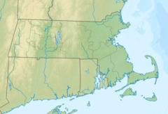
Location of trailheads in MassachusettsThe Canalside Rail Trail is a 3.8-mile (6.1 km) trail, partially on old railroad beds, from East Deerfield to Turners Falls in Montague, Massachusetts, US. A short portion of the trail runs along town streets, but the majority is on a paved trail from which motor vehicles are prohibited. The northern terminus is Unity Park, on Barton's Cove in Turners Falls. The southernmost portion crosses the Connecticut River on the Canalside Rail Trail Bridge[1] and ends at McClelland Farm Road in Deerfield.[2] The trail was completed in spring 2008.
See also
- Turners Falls branch (New Haven)
References
External links
Wikimedia Commons has media related to Canalside Rail Trail.
- Canalside Rail Trail, Massachusetts Department of Conservation and Recreation
- Canalside Rail Trail Map, Massachusetts Department of Conservation and Recreation
- v
- t
- e
Protected areas of Massachusetts
| |||||||||||||
|
| |||||
|
|
Audubon Society wildlife sanctuaries | |
|---|---|
|
Other | |
|---|---|
|
 Category
- Boston
- Emerald Necklace
- Executive Office of Energy and Environmental Affairs
 Commons

| ||
|---|---|---|
|  | |


 Canalside_Rail_Trail