Dhalaa
Commune and town in Oum El Bouaghi Province, Algeria
Dhalaa الضلعة | |
|---|---|
Commune and town | |
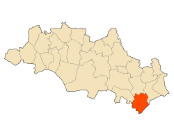 Location of the municipality in the wilaya of Oum El Bouaghi. | |
| Coordinates: 35°27′40″N 7°32′50″E / 35.46111°N 7.547222°E / 35.46111; 7.547222 | |
| Country |  Algeria Algeria |
| Province | Oum El Bouaghi Province |
| Area | |
| • Total | 79 sq mi (205 km2) |
| Population (2008[1]) | |
| • Total | 11,439 |
| Time zone | UTC+1 (CET) |
Dhalaa is a town and commune in Oum El Bouaghi Province, Algeria.
Localities of the commune
The commune is composed of 21 localities:[2]
- Centre de Dhalâa
- Raf Raf
- Messlaf
- Benaïm
- Gabel Zebar
- Ouled Chamiekh
- Reggada
- Argoub Tine
- Gabel Lefdjidjet
- Dagher
- Fedj Tine
- Oglia
- Dhahret El Oued
- Gabel Boutekhma
- Argoub El Bey
- Henchir El Khadem
- Lekmine
- Ayoune Dekhakhène
- Lehguina
- Remaïdia
- Ras Zebar
- Kef El Aks
References
- ^ "Wilaya d'Oum El Bouaghi : répartition de la population résidente des ménages ordinaires et collectifs, selon la commune de résidence et la dispersion" (PDF).. Données du recensement général de la population et de l'habitat de 2008 sur le site de l'ONS.
- ^ "Décret n° 84-365, fixant la composition, la consistance et les limites territoriale des communes. Wilaya d`oum El Bouagh" [Decree n ° 84-365, fixing the composition, the consistency and the territorial limits of the communes. Wilaya d`oum El Bouagh] (PDF). Journal officiel de la République Algérienne (in French) (68): 1478. 19 December 1984. Retrieved 3 October 2019.
- v
- t
- e
Capital: Oum El Bouaghi
- Aïn Babouche
- Aïn Beïda
- Aïn Fakroun
- Aïn Kechra
- Aïn M'Lila
- Dhalaâ
- F'Kirina
- Ksar Sbahi
- Meskiana
- Oum El Bouaghi
- Sigus
- Souk Naâmane

- Oum el Bouaghi
- Aïn Babouche
- Aïn Beida
- Aïn Diss
- Aïn Fakroun
- Aïn Kercha
- Aïn M'lila
- Aïn Zitoun
- Behir Chergui
- Berriche
- Bir Chouhada
- Dhalaa
- El Amiria
- El Belala
- El Djazia
- El Fedjouz Boughrara Saoudi
- El Harmilia
- Fkirina
- Hanchir Toumghani
- Ksar Sbahi
- Meskiana
- Oued Nini
- Ouled Gacem
- Ouled Hamla
- Ouled Zouaï
- Rahia
- Sigus
- Souk Naamane
- Zorg
35°27′40″N 7°32′50″E / 35.461111°N 7.547222°E / 35.461111; 7.547222
 | This article about a location in Oum El Bouaghi Province is a stub. You can help Wikipedia by expanding it. |
- v
- t
- e


 Dhalaa