Gagarin, Armenia
40°32′13″N 44°51′28″E / 40.53694°N 44.85778°E / 40.53694; 44.85778
Place in Gegharkunik, Armenia
Gagarin Գագարին | |
|---|---|
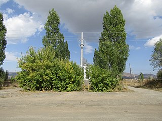
 Main road in Gagarin | |
 Coat of arms | |
  Gagarin  Gagarin | |
| Coordinates: 40°32′13″N 44°51′28″E / 40.53694°N 44.85778°E / 40.53694; 44.85778 | |
| Country | Armenia |
| Province | Gegharkunik |
| Municipality | Sevan |
| Founded | 1955 |
| Population (2011)[1] | |
| • Total | 1,379 |
| Time zone | UTC+4 (AMT) |
| Gagarin, Armenia at GEOnet Names Server | |
Gagarin (Armenian: Գագարին) is a village in the Sevan Municipality of the Gegharkunik Province of Armenia. It was founded in 1955 and named after the cosmonaut Yuri Gagarin.[2] Administratively, the village is under the subordination of the Sevan municipality.
Gallery
-
 Yuri Gagarin's monument
 -
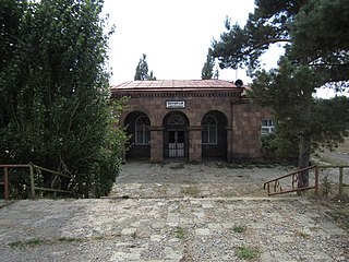 Gagarin train station
 -
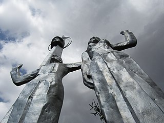 Yuri Gagarin's monument
 -
 Scenery around Gagarin


References
- ^ Statistical Committee of Armenia. "The results of the 2011 Population Census of Armenia" (PDF).
- ^ Kiesling, Rediscovering Armenia, p. 41, available online at the US embassy to Armenia's website Archived June 26, 2008, at the Wayback Machine
External links
Wikimedia Commons has media related to Gagarin (village).
- Report of the results of the 2001 Armenian Census, Statistical Committee of Armenia
- v
- t
- e
 Gegharkunik Province
Capital: Gavar
- Chambarak
- Gavar
- Martuni
- Sevan
- Vardenis

- Antaramej
- Artsvashen
- Aygut
- Barepat
- Chapkut
- Dprabak
- Dzoravank
- Getik
- Kalavan
- Martuni (village)
- Ttujur
- Vahan
- Akhpradzor
- Akunk
- Areguni
- Arpunk
- Avazan
- Ayrk
- Azat
- Daranak
- Geghakar
- Geghamabak
- Geghamasar
- Jaghatsadzor
- Kakhakn
- Karchaghbyur
- Khachaghbyur
- Kut
- Kutakan
- Lchavan
- Lusakunk
- Makenis
- Mets Masrik
- Nerkin Shorzha
- Norabak
- Norakert
- Pambak
- Pokr Masrik
- Shatjrek
- Shatvan
- Sotk
- Torfavan
- Tretuk
- Tsovak
- Vanevan
- Verin Shorzha
- Zariver
Portal:
 Geography

 | This article about a location in Gegharkunik Province, Armenia is a stub. You can help Wikipedia by expanding it. |
- v
- t
- e


 Gagarin,_Armenia