Kaľava
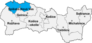
Kaľava (Hungarian: Szepeskárolyfalva, until 1899 Kalyava) is a village and municipality in the Spišská Nová Ves District in the Košice Region of central-eastern Slovakia. The village is situated on the southern side of the mountains Branisko.
History
In historical records the village was first mentioned in 1300.
Geography
The village lies at an altitude of 560 metres and covers an area of 4.45 km². It has a population of about 427 inhabitants.
Genealogical resources
The records for genealogical research are available at the state archive "Statny Archiv in Levoca, Slovakia"
- Roman Catholic church records (births/marriages/deaths): 1722-1918 (parish B)
See also
External links
- http://www.kalava.sk
- Surnames of living people in Kalava
- v
- t
- e
Municipalities of Spišská Nová Ves District
- Krompachy
- Spišská Nová Ves
- Spišské Vlachy
- Arnutovce
- Betlanovce
- Bystrany
- Danišovce
- Harichovce
- Hincovce
- Hnilčík
- Hnilec
- Hrabušice
- Chrasť nad Hornádom
- Iliašovce
- Jamník
- Kaľava
- Kolinovce
- Letanovce
- Lieskovany
- Markušovce
- Matejovce
- Mlynky
- Odorín
- Olcnava
- Oľšavka
- Poráč
- Rudňany
- Slatvina
- Slovinky
- Smižany
- Spišské Tomášovce
- Spišský Hrušov
- Teplička
- Vítkovce
- Vojkovce
- Žehra

48°56′N 20°52′E / 48.933°N 20.867°E / 48.933; 20.867
 | This Košice Region geography article is a stub. You can help Wikipedia by expanding it. |
- v
- t
- e


 Kaľava