Katogo
Town and sub-prefecture in Savanes, Ivory Coast
Katogo Katoro | |
|---|---|
Town and sub-prefecture | |
| 10°9′N 6°8′W / 10.150°N 6.133°W / 10.150; -6.133 | |
| Country |  Ivory Coast Ivory Coast |
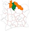
| District | Savanes |
| Region | Poro |
| Department | M'Bengué |
| Population (2014)[1] | |
| • Total | 14,862 |
| Time zone | UTC+0 (GMT) |
Katogo (also known as Katoro) is a town in the far north of Ivory Coast. It is a sub-prefecture of M'Bengué Department in Poro Region, Savanes District. Seven kilometres north of town is a border crossing with Mali.
Kotogo was a commune until March 2012, when it became one of 1126 communes nationwide that were abolished.[2]
In 2014, the population of the sub-prefecture of Katogo was 14,862.[3]
Villages
The 14 villages of the sub-prefecture of Katogo and their population in 2014 are:[3]
- Famitieguele (408)
- Kafonon (37)
- Kaniene (830)
- Kantara (2 042)
- Kassiolo (382)
- Katogo (4 451)
- Kolian (680)
- N'dienkaha (708)
- Netoulou (539)
- N'golokaha (477)
- Seguebe (525)
- Solognougo (1 022)
- Souhouo (547)
- Tiorotieri (2 214)
Notes
- ^ "Côte d'Ivoire". geohive.com. Retrieved 11 December 2015.
- ^ "Le gouvernement ivoirien supprime 1126 communes, et maintient 197 pour renforcer sa politique de décentralisation en cours", news.abidjan.net, 7 March 2012.
- ^ a b "RGPH 2014, Répertoire des localités, Région Poro" (PDF). ins.ci. Retrieved 5 August 2019.
- v
- t
- e
Departments and sub-prefectures of Poro Region, Savanes DistrictRegional seat: Korhogo
- Boron
- Dikodougou*
- Guiembé*
- Dassoungboho
- Kanoroba
- Karakoro*
- Kiémou
- Kombolokoura
- Komborodougou*
- Koni
- Korhogo*
- Lataha
- Nafoun
- Napiéolédougou*
- N'Ganon
- Niofoin*
- Sirasso*
- Sohouo
- Tioroniaradougou*
* also a commune
 | This Savanes District location article is a stub. You can help Wikipedia by expanding it. |
- v
- t
- e


 Katogo