Koulpélogo Province
Province in Centre-Est Region, Burkina Faso
Koulpélogo | |
|---|---|
Province | |
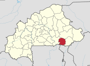 Location in Burkina Faso | |
 Provincial map of its departments | |
| Country |  Burkina Faso Burkina Faso |
| Region | Centre-Est Region |
| Capital | Ouargaye |
| Area | |
| • Province | 5,348 km2 (2,065 sq mi) |
| Population (2019 census)[1] | |
| • Province | 361,586 |
| • Density | 68/km2 (180/sq mi) |
| • Urban | 13,431 |
| Time zone | UTC+0 (GMT 0) |
Koulpélogo is one of the 45 provinces of Burkina Faso, located in its Centre-Est Region. The population in 2019 was 361,586.[1]
Its capital is Ouargaye.
Departments
Koulpelogo is divided into 8 departments:
| Department | Capital city | Population (Census 2006)[2] |
|---|---|---|
| Comin-Yanga Department | Comin-Yanga | 37,985 |
| Dourtenga Department | Dourtenga | 9,538 |
| Lalgaye Department | Lalgaye | 15,063 |
| Ouargaye Department | Ouargaye | 34,288 |
| Sangha Department | Sangha | 46,461 |
| Soudougui Department | Soudougui | 49,310 |
| Yargatenga Department | Yargatenga | 41,009 |
| Yondé Department | Yondé | 25,741 |
See also
References
- ^ a b Citypopulation.de Population of provinces in Centre-Est Region
- ^ "National 2006 census preliminary results" (PDF). Archived from the original (PDF) on 2015-07-21. Retrieved 2014-10-16.
- v
- t
- e
- Balé
- Bam
- Banwa
- Bazèga
- Bougouriba
- Boulgou
- Boulkiemdé
- Comoé
- Ganzourgou
- Gnagna
- Gourma
- Houet
- Ioba
- Kadiogo
- Kénédougou
- Komondjari
- Kompienga
- Kossi
- Koulpélogo
- Kouritenga
- Kourwéogo
- Léraba
- Loroum
- Mouhoun
- Nahouri
- Namentenga
- Nayala
- Noumbiel
- Oubritenga
- Oudalan
- Passoré
- Poni
- Sanguié
- Sanmatenga
- Séno
- Sissili
- Soum
- Sourou
- Tapoa
- Tuy
- Yagha
- Yatenga
- Ziro
- Zondoma
- Zoundwéogo

11°25′N 0°10′E / 11.417°N 0.167°E / 11.417; 0.167
 | This Koulpélogo Province location article is a stub. You can help Wikipedia by expanding it. |
- v
- t
- e


