List of Ramsar sites in Scotland
This list includes all Ramsar sites in Scotland. Ramsar sites are internationally recognised wetland sites, protected under the terms of the Ramsar Convention, which was developed and adopted by participating nations at a meeting in Ramsar, Iran, on 2 February 1971. At the end of 2010, 160 states were contracting parties to the convention, and the worldwide total of sites was 1,920. The United Kingdom was one of 18 original signatories to the convention, and has since designated 168 Ramsar sites. 51 of these sites are within Scotland, including one site, the Upper Solway Flats and Marshes, which covers parts of both Scotland and England in the Solway Firth. The total area of all Ramsar sites in Scotland is approximately 313,500 hectares (775,000 acres).[1] All of Scotland's Ramsar sites form part of the European Natura 2000 network as either Special Protection Areas or Special Areas of Conservation, and many sites are further protected as Sites of Special Scientific Interest under UK legislation.
Map all coordinates using OpenStreetMap
Download coordinates as:
- KML
- GPX (all coordinates)
- GPX (primary coordinates)
- GPX (secondary coordinates)
List of Ramsar sites in Scotland
| Name[1] | Council area | Designated | Area (hectares) | Coordinates | Site code | Image |
|---|---|---|---|---|---|---|
| Bridgend Flats, Islay | Argyll and Bute | 1988-07-14 | 331 | 55°46′0″N 6°16′0″W / 55.76667°N 6.26667°W / 55.76667; -6.26667 (Bridgend Flats) | UK13001 | |
| Cairngorm Lochs | Aberdeenshire / Highland / Moray | 1981-07-24 | 173 | 57°4′0″N 3°47′0″W / 57.06667°N 3.78333°W / 57.06667; -3.78333 (Cairngorm Lochs) | UK13002 |  |
| Caithness and Sutherland Peatlands | Highland | 1999-02-02 | 143,503 | 58°20′0″N 3°56′0″W / 58.33333°N 3.93333°W / 58.33333; -3.93333 (Caithness and Sutherland Peatlands) | UK13003 |  |
| Caithness Lochs | Highland | 1998-02-02 | 1,379 | 58°29′0″N 3°20′0″W / 58.48333°N 3.33333°W / 58.48333; -3.33333 (Caithness Lochs) | UK13004 |  |
| Cameron Reservoir | Fife | 1994-03-14 | 69 | 56°18′0″N 2°51′0″W / 56.30000°N 2.85000°W / 56.30000; -2.85000 (Cameron Reservoir) | UK13005 | 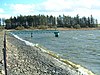 |
| Castle Loch, Lochmaben | Dumfries and Galloway | 1996-03-15 | 108 | 55°7′0″N 3°26′0″W / 55.11667°N 3.43333°W / 55.11667; -3.43333 (Castle Loch) | UK13006 |  |
| Claish Moss | Highland | 1981-07-24 | 568 | 56°44′0″N 5°44′0″W / 56.73333°N 5.73333°W / 56.73333; -5.73333 (Claish Moss) | UK13007 | |
| Coll | Argyll and Bute | 1995-03-31 | 2,209 | 56°39′0″N 6°30′0″W / 56.65000°N 6.50000°W / 56.65000; -6.50000 (Coll) | UK13008 |  |
| Cromarty Firth | Highland | 1999-07-22 | 3,747 | 57°41′0″N 4°12′0″W / 57.68333°N 4.20000°W / 57.68333; -4.20000 (Cromarty Firth) | UK13009 |  |
| Din Moss - Hoselaw Loch | Scottish Borders | 1988-07-14 | 51 | 55°35′0″N 2°18′0″W / 55.58333°N 2.30000°W / 55.58333; -2.30000 (Din Moss - Hoselaw Loch) | UK13010 | |
| Dornoch Firth and Loch Fleet | Highland | 1997-03-24 | 7,837 | 57°51′0″N 4°2′0″W / 57.85000°N 4.03333°W / 57.85000; -4.03333 (Dornoch Firth andLoch Fleet) | UK13011 | 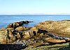 |
| East Sanday Coast | Orkney | 1997-08-11 | 1,515 | 59°16′0″N 2°34′0″W / 59.26667°N 2.56667°W / 59.26667; -2.56667 (East Sanday Coast) | UK13013 | |
| Eilean na Muice Duibhe (Duich Moss), Islay | Argyll and Bute | 1988-07-14 | 576 | 55°43′0″N 6°15′0″W / 55.71667°N 6.25000°W / 55.71667; -6.25000 (Eilean na Muice Duibhe) | UK13014 | |
| Fala Flow | Midlothian | 1990-04-25 | 318 | 55°49′0″N 2°54′0″W / 55.81667°N 2.90000°W / 55.81667; -2.90000 (Fala Flow) | UK13015 | |
| Firth of Forth | Clackmannanshire / East Lothian / Edinburgh / Falkirk / Fife /Stirling / West Lothian | 2001-10-30 | 6,314 | 56°1′0″N 2°53′0″W / 56.01667°N 2.88333°W / 56.01667; -2.88333 (Firth of Forth) | UK13017 |  |
| Firth of Tay & Eden Estuary | Angus / Dundee / Fife / Perth and Kinross | 2000-07-28 | 6,918 | 56°24′0″N 3°5′0″W / 56.40000°N 3.08333°W / 56.40000; -3.08333 (Firth of Tay and Eden Estuary) | UK13018 |  |
| Gladhouse Reservoir | Midlothian | 1988-07-14 | 186 | 55°47′0″N 3°6′0″W / 55.78333°N 3.10000°W / 55.78333; -3.10000 (Gladhouse Reservoir) | UK13021 | 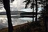 |
| Greenlaw Moor | Scottish Borders | 1996-03-15 | 248 | 55°44′0″N 2°27′0″W / 55.73333°N 2.45000°W / 55.73333; -2.45000 (Greenlaw Moor) | UK13022 | |
| Gruinart Flats, Islay | Argyll and Bute | 1988-07-14 | 3,261 | 55°51′0″N 6°20′0″W / 55.85000°N 6.33333°W / 55.85000; -6.33333 (Gruinart Flats) | UK13023 |  |
| Inner Clyde Estuary | East Dunbartonshire / Inverclyde / Renfrewshire / West Dunbartonshire | 2000-09-05 | 1,825 | 55°57′0″N 4°38′0″W / 55.95000°N 4.63333°W / 55.95000; -4.63333 (Inner Clyde Estuary) | UK13024 | |
| Inner Moray Firth | Highland | 1999-07-22 | 2,339 | 56°50′0″N 4°21′0″W / 56.83333°N 4.35000°W / 56.83333; -4.35000 (Inner Moray Firth) | UK13025 |  |
| Kintyre Goose Roosts | Argyll and Bute | 1998-10-28 | 312 | 55°31′0″N 5°37′0″W / 55.51667°N 5.61667°W / 55.51667; -5.61667 (Kintyre Goose Roosts) | UK13027 | 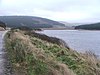 |
| Lewis Peatlands | Na h-Eileanan Siar | 2000-12-22 | 58,984 | 58°15′0″N 6°35′0″W / 58.25000°N 6.58333°W / 58.25000; -6.58333 (Lewis Peatlands) | UK13028 | |
| Loch an Duin | Na h-Eileanan Siar | 1990-04-25 | 2,621 | 57°38′0″N 7°9′0″W / 57.63333°N 7.15000°W / 57.63333; -7.15000 (Loch an Dùin) | UK13029 | |
| Loch Eye | Highland | 1986-10-01 | 205 | 57°47′0″N 3°58′0″W / 57.78333°N 3.96667°W / 57.78333; -3.96667 (Loch Eye) | UK13031 |  |
| Loch Ken and River Dee Marshes | Dumfries and Galloway | 1992-08-31 | 769 | 54°59′0″N 4°1′0″W / 54.98333°N 4.01667°W / 54.98333; -4.01667 (Loch Ken and River Dee Marshes) | UK13032 |  |
| Loch Leven | Perth and Kinross | 1976-01-05 | 1,612 | 56°12′0″N 3°23′0″W / 56.20000°N 3.38333°W / 56.20000; -3.38333 (Loch Leven) | UK13033 |  |
| Loch Lomond | Stirling / West Dunbartonshire | 1976-01-05 | 237 | 56°4′0″N 4°30′0″W / 56.06667°N 4.50000°W / 56.06667; -4.50000 (Loch Lomond) | UK13034 |  |
| Loch Maree | Highland | 1994-09-19 | 3,174 | 57°41′0″N 5°28′0″W / 57.68333°N 5.46667°W / 57.68333; -5.46667 (Loch Maree) | UK13035 |  |
| Loch of Inch and Torrs Warren | Dumfries and Galloway | 1999-02-02 | 2,111 | 54°50′0″N 4°52′0″W / 54.83333°N 4.86667°W / 54.83333; -4.86667 (Loch of Inch and Torrs Warren) | UK13037 | |
| Loch of Kinnordy | Angus | 1994-03-29 | 85 | 56°40′0″N 3°3′0″W / 56.66667°N 3.05000°W / 56.66667; -3.05000 (Loch of Kinnordy) | UK13038 |  |
| Loch of Lintrathen | Angus | 1981-07-24 | 217 | 56°41′0″N 3°11′0″W / 56.68333°N 3.18333°W / 56.68333; -3.18333 (Loch of Lintrathen) | UK13039 | |
| Loch of Skene | Aberdeenshire | 1986-10-01 | 121 | 57°9′0″N 2°21′0″W / 57.15000°N 2.35000°W / 57.15000; -2.35000 (Loch of Skene) | UK13040 |  |
| Loch of Strathbeg | Aberdeenshire | 1995-11-27 | 616 | 57°37′0″N 1°53′0″W / 57.61667°N 1.88333°W / 57.61667; -1.88333 (Loch of Strathbeg) | UK13041 |  |
| Loch Ruthven | Highland | 1996-08-16 | 201 | 57°20′0″N 4°17′0″W / 57.33333°N 4.28333°W / 57.33333; -4.28333 (Loch Ruthven) | UK13042 |  |
| Loch Spynie | Moray | 1992-08-31 | 94 | 57°41′0″N 3°17′0″W / 57.68333°N 3.28333°W / 57.68333; -3.28333 (Loch Spynie) | UK13043 |  |
| Montrose Basin | Angus | 1995-02-03 | 985 | 56°43′0″N 2°30′0″W / 56.71667°N 2.50000°W / 56.71667; -2.50000 (Montrose Basin) | UK13046 |  |
| Moray and Nairn Coast | Highland / Moray | 1997-02-02 | 2,412 | 57°39′0″N 3°44′0″W / 57.65000°N 3.73333°W / 57.65000; -3.73333 (Moray and Nairn Coast) | UK13048 | |
| Muir of Dinnet | Aberdeenshire | 1999-07-22 | 158 | 57°5′0″N 2°55′0″W / 57.08333°N 2.91667°W / 57.08333; -2.91667 (Muir of Dinnet) | UK13049 |  |
| North Uist Machair and Islands | Na h-Eileanan Siar | 1999-07-22 (extended 2000-11-03) | 4,705 | 57°32′0″N 7°23′0″W / 57.53333°N 7.38333°W / 57.53333; -7.38333 (North Uist Machair and Islands) | UK13050 | |
| Rannoch Moor | Perth and Kinross | 1976-01-05 | 1,519 | 56°39′0″N 4°36′0″W / 56.65000°N 4.60000°W / 56.65000; -4.60000 (Rannoch Moor) | UK13051 |  |
| Rinns of Islay | Argyll and Bute | 1990-04-25 | 3,571 | 55°51′0″N 6°23′0″W / 55.85000°N 6.38333°W / 55.85000; -6.38333 (Rinns of Islay) | UK13052 |  |
| River Spey – Insh Marshes | Highland | 1997-02-02 | 1,159 | 57°5′0″N 4°0′0″W / 57.08333°N 4.00000°W / 57.08333; -4.00000 (River Spey - Insh Marshes) | UK13053 |  |
| Ronas Hill – North Roe and Tingon | Shetland | 1997-08-11 | 5,470 | 60°33′0″N 1°25′0″W / 60.55000°N 1.41667°W / 60.55000; -1.41667 (Ronas Hill – North Roe and Tingon) | UK13054 | 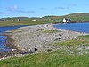 |
| Silver Flowe | Dumfries and Galloway | 1981-07-24 | 620 | 55°7′0″N 4°24′0″W / 55.11667°N 4.40000°W / 55.11667; -4.40000 (Silver Flowe) | UK13055 |  |
| Sléibhtean agus Cladach Thiriodh (Tiree Wetlands and Coast) | Argyll and Bute | 2001-11-16 | 1,939 | 56°30′0″N 6°52′0″W / 56.50000°N 6.86667°W / 56.50000; -6.86667 (Sléibhtean agus Cladach Thiriodh) | UK13056 | |
| South Tayside Goose Roosts | Perth and Kinross | 1993-04-22 | 331 | 56°16′0″N 3°50′0″W / 56.26667°N 3.83333°W / 56.26667; -3.83333 (South Tayside Goose Roosts) | UK13057 | |
| South Uist Machair and Lochs | Na h-Eileanan Siar | 1976-01-05 | 5,019 | 57°19′0″N 7°20′0″W / 57.31667°N 7.33333°W / 57.31667; -7.33333 (South Uist Machair and Lochs) | UK13058 | |
| Upper Solway Flats and Marshes | Dumfries and Galloway / Cumbria | 1986-10-01 | 43,637 | 54°54′0″N 3°25′0″W / 54.90000°N 3.41667°W / 54.90000; -3.41667 (Upper Solway Flats and Marshes) | UK11079 | |
| Westwater | Scottish Borders | 1995-11-27 | 50 | 55°45′0″N 3°24′0″W / 55.75000°N 3.40000°W / 55.75000; -3.40000 (Westwater Reservoir) | UK13060 | 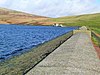 |
| Ythan Estuary and Meikle Loch | Aberdeenshire | 1998-03-30 | 314 | 57°20′0″N 1°57′0″W / 57.33333°N 1.95000°W / 57.33333; -1.95000 (Ythan Estuary and Meikle Loch) | UK13061 |  |
See also
References
- ^ a b "Ramsar List" (PDF). Ramsar.org. Retrieved 31 March 2013.
- "The Annotated Ramsar List: United Kingdom". The Ramsar Convention on Wetlands. 5 September 2009.
- "Designated and Proposed Ramsar sites in Scotland". Joint Nature Conservation Committee.
- "Ramsar sites". Scottish Natural Heritage. Archived from the original on 29 December 2010. Retrieved 8 March 2011.
- v
- t
- e
Nature
Reserves
- Abernethy Forest
- Ariundle Oakwood
- Beinn Eighe
- Ben Lawers
- Ben Wyvis
- Blawhorn Moss
- Caerlaverock
- Cairnsmore of Fleet
- Clyde Valley Woodlands
- Corrie Fee
- Corrieshalloch Gorge National Nature Reserve
- Craigellachie
- Creag Meagaidh
- Flanders Moss
- Forsinard Flows
- Forvie
- Glasdrum Wood
- Glen Affric National Nature Reserve
- Glen Nant
- Glen Roy
- Glen Tanar
- Glenmore
- The Great Trossachs Forest
- Hermaness
- Insh Marshes
- Invereshie and Inshriach
- Isle of May
- Knockan Crag
- Loch Fleet
- Loch Leven
- Loch Lomond
- Moine Mhor
- Muir of Dinnet
- Noss
- Rum
- St Abb's Head
- St Cyrus
- St Kilda
- Staffa
- Taynish
- Tentsmuir Forest
reserves
- Abernethy Forest
- Ailsa Craig
- Balranald Nature Reserve
- Coll
- Copinsay
- Corrimony
- Culbin Sands
- Dunnet Head
- Fetlar
- Fidra
- Forsinard Flows
- Fowlsheugh
- Glenborrodale
- Hoy
- Insh Marshes
- Inversnaid
- Loch Garten
- Loch Gruinart
- Loch of Strathbeg
- Loch Ruthven
- Lochs of Spiggie and Brow
- Lochwinnoch
- Mill Dam
- Mousa
- Mull of Galloway
- Nigg Bay
- The Oa
- Sumburgh Head
- Trumland
 Scotland portal
| |||||||
|---|---|---|---|---|---|---|---|
| Physical |
| ||||||
| Environment |
| ||||||
| Land use | |||||||
| Administrative |
| ||||||
| Social | |||||||
Scotland portal
| |||||||


