List of airports in Cuba
This is a list of airports in Cuba, grouped by type and sorted by location.
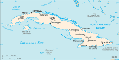
Cuba, officially the Republic of Cuba, is an island country in the Caribbean. It is an archipelago of islands located in the northern Caribbean Sea at the confluence with the Gulf of Mexico and the Atlantic Ocean. The United States lies to the northwest, the Bahamas to the north, Haiti to the east, Jamaica and the Cayman Islands to the south, and Mexico to the west. The country is subdivided into 15 provinces and one special municipality (Isla de la Juventud, the country's second largest island). Cuba's capital and largest city is Havana.
Airports
Map all coordinates using OpenStreetMap
Download coordinates as:
- KML
- GPX (all coordinates)
- GPX (primary coordinates)
- GPX (secondary coordinates)
Airport names shown in bold have scheduled passenger service on commercial airlines.
| Location served | Province | ICAO | IATA | Airport name | Coordinates
|
|---|---|---|---|---|---|
| Public airports | |||||
| Baracoa | Guantánamo | MUBA | BCA | Gustavo Rizo Airport | 20°21′55″N 074°30′22″W / 20.36528°N 74.50611°W / 20.36528; -74.50611 (Gustavo Rizo Airport) |
| Bayamo | Granma | MUBY | BYM | Carlos Manuel de Céspedes Airport | 20°23′47″N 076°37′17″W / 20.39639°N 76.62139°W / 20.39639; -76.62139 (Carlos Manuel de Céspedes Airport) |
| Camagüey | Camagüey | MUCM | CMW | Ignacio Agramonte International Airport | 21°25′13″N 077°50′51″W / 21.42028°N 77.84750°W / 21.42028; -77.84750 (Ignacio Agramonte International Airport) |
| Cayo Coco | Ciego de Ávila | MUCC | CCC | Jardines del Rey Airport | 22°27′40″N 078°19′43″W / 22.46111°N 78.32861°W / 22.46111; -78.32861 (Jardines del Rey Airport) |
| Cayo Largo del Sur | Isla de la Juventud | MUCL | CYO | Vilo Acuña Airport (Juan Vitalio Acuña Airport) | 21°36′58″N 81°32′44″W / 21.61611°N 81.54556°W / 21.61611; -81.54556 (Vilo Acuña Airport) |
| Cayo Santa Maria | Villa Clara | MUBR | BWW | Las Brujas Airport | 22°37′16″N 079°08′50″W / 22.62111°N 79.14722°W / 22.62111; -79.14722 (Las Brujas Airport) |
| Ciego de Ávila | Ciego de Ávila | MUCA | AVI | Máximo Gómez Airport | 22°01′37″N 078°47′22″W / 22.02694°N 78.78944°W / 22.02694; -78.78944 (Máximo Gómez Airport) |
| Cienfuegos | Cienfuegos | MUCF | CFG | Jaime González Airport | 22°09′00″N 080°23′51″W / 22.15000°N 80.39750°W / 22.15000; -80.39750 (Jaime González Airport) |
| Florida | Camagüey | MUFL | Florida Airport | 21°29′59″N 078°12′10″W / 21.49972°N 78.20278°W / 21.49972; -78.20278 (Florida Airport) | |
| Guantánamo | Guantánamo | MUGT | GAO | Mariana Grajales Airport | 20°05′07″N 075°09′29″W / 20.08528°N 75.15806°W / 20.08528; -75.15806 (Mariana Grajales Airport) |
| Guardalavaca | Holguín | MUGV | Guardalavaca Airport | 21°06′40″N 75°49′20″W / 21.11111°N 75.82222°W / 21.11111; -75.82222 (Guardalavaca Airport) | |
| Havana | Havana | MUHA | HAV | José Martí International Airport | 22°59′21″N 082°24′33″W / 22.98917°N 82.40917°W / 22.98917; -82.40917 (José Martí International Airport) |
| Havana | Artemisa | MUPB | UPB | Playa Baracoa Airport | 23°01′58″N 082°34′46″W / 23.03278°N 82.57944°W / 23.03278; -82.57944 (Playa Baracoa Airport) |
| Holguín | Holguín | MUHG | HOG | Frank País Airport | 20°46′44″N 076°18′44″W / 20.77889°N 76.31222°W / 20.77889; -76.31222 (Frank País Airport) |
| Las Tunas | Las Tunas | MUVT | VTU | Hermanos Ameijeiras Airport | 20°59′16″N 076°56′09″W / 20.98778°N 76.93583°W / 20.98778; -76.93583 (Hermanos Ameijeiras Airport) |
| Manzanillo | Granma | MUMZ | MZO | Sierra Maestra Airport | 20°17′20″N 077°05′12″W / 20.28889°N 77.08667°W / 20.28889; -77.08667 (Sierra Maestra Airport) |
| Moa | Holguín | MUMO | MOA | Orestes Acosta Airport | 20°39′14″N 74°55′20″W / 20.65389°N 74.92222°W / 20.65389; -74.92222 (Orestes Acosta Airport) |
| Nueva Gerona | Isla de la Juventud | MUNG | GER | Rafael Cabrera Mustelier Airport | 21°50′05″N 082°47′02″W / 21.83472°N 82.78389°W / 21.83472; -82.78389 (Rafael Cabrera Airport) |
| Nueva Gerona | Isla de la Juventud | MUSN | SZJ | Siguanea Airport | 21°38′33″N 082°57′18″W / 21.64250°N 82.95500°W / 21.64250; -82.95500 (Siguanea Airport) |
| Pinar del Río | Pinar del Río | MULM | LCL | La Coloma Airport | 22°20′11″N 083°38′32″W / 22.33639°N 83.64222°W / 22.33639; -83.64222 (La Coloma Airport) |
| Punta de Maisí | Guantánamo | MUMA | UMA | Punta de Maisí Airport | 20°14′35″N 74°08′50″W / 20.24306°N 74.14722°W / 20.24306; -74.14722 (Punta de Maisí Airport) |
| San Nicolás de Bari | Mayabeque | MUNB | QSN | San Nicolás de Bari Airport | 22°45′23″N 081°55′15″W / 22.75639°N 81.92083°W / 22.75639; -81.92083 (San Nicolás de Bari Airport) |
| Sancti Spíritus | Sancti Spíritus | MUSS | USS | Sancti Spíritus Airport | 21°58′12″N 079°26′34″W / 21.97000°N 79.44278°W / 21.97000; -79.44278 (Sancti Spíritus Airport) |
| Santa Clara | Villa Clara | MUSC | SNU | Abel Santamaría Airport | 22°29′32″N 079°56′37″W / 22.49222°N 79.94361°W / 22.49222; -79.94361 (Abel Santamaría Airport) |
| Santa Lucía | Camagüey | MUSL | Joaquín de Agüero Airport (Santa Lucia Airport) | 21°30′34″N 077°01′13″W / 21.50944°N 77.02028°W / 21.50944; -77.02028 (Joaquín de Agüero Airport) | |
| Santiago de Cuba | Santiago de Cuba | MUCU | SCU | Antonio Maceo Airport | 19°58′12″N 075°50′08″W / 19.97000°N 75.83556°W / 19.97000; -75.83556 (Antonio Maceo Airport) |
| Trinidad | Sancti Spíritus | MUTD | TND | Alberto Delgado Airport | 21°47′18″N 79°59′50″W / 21.78833°N 79.99722°W / 21.78833; -79.99722 (Alberto Delgado Airport) |
| Varadero | Matanzas | MUVR | VRA | Juan Gualberto Gómez Airport | 23°02′04″N 81°26′07″W / 23.03444°N 81.43528°W / 23.03444; -81.43528 (Juan Gualberto Gómez Airport) |
| Varadero | Matanzas | MUKW | Kawama Airport | 23°07′25″N 081°18′07″W / 23.12361°N 81.30194°W / 23.12361; -81.30194 (Kawama Airport) | |
| Military airports | |||||
| Guantánamo Bay | Guantánamo | MUGM | NBW | Leeward Point Field (Naval Station Guantanamo Bay) | 19°54′23″N 075°12′25″W / 19.90639°N 75.20694°W / 19.90639; -75.20694 (Leeward Point Field) |
| Havana | Havana | MUMG | Managua Airport | 22°58′12″N 82°16′30″W / 22.97000°N 82.27500°W / 22.97000; -82.27500 (Managua Airport) | |
| Havana | Havana | MULB | Ciudad Libertad Airport | 23°05′38″N 082°26′17″W / 23.09389°N 82.43806°W / 23.09389; -82.43806 (Ciudad Libertad Airport) | |
| Pinar del Río | Pinar del Río | MUSJ | SNJ | San Julian Air Base | 22°05′43″N 084°09′07″W / 22.09528°N 84.15194°W / 22.09528; -84.15194 (San Julian Air Base) |
| San Antonio de los Baños | Artemisa | MUSA | San Antonio de los Baños Air Base | 22°52′18″N 082°30′34″W / 22.87167°N 82.50944°W / 22.87167; -82.50944 (San Antonio de los Baños Air Base) | |
| Closed airports | |||||
| Caibarién | Villa Clara | MUCB | Caibarién Airport (abandoned) | ||
| Cayo Coco | Ciego de Ávila | MUOC | Cayo Coco Airport (abandoned) | ||
| Mariel | Artemisa | MUML | Mariel Airport (abolished) | ||
| Mayajigua | Sancti Spiritus | MJG | Mayajigua Airport (abandoned) | ||
| Nicaro | Holguín | MUNC | ICR | Nicaro Airport (abandoned) | |
| Pinar del Río | Pinar del Río | MUPR | QPD | Pinar del Río Airport (abandoned) | 22°25′17″N 083°40′42″W / 22.42139°N 83.67833°W / 22.42139; -83.67833 (Pinar del Río Airport) |
| Preston | Holguín | PST | Preston Airport (abandoned) | ||
See also
Wikimedia Commons has media related to Airports in Cuba.
- Transportation in Cuba
- Military of Cuba
- List of airports in the Caribbean
- List of airports by ICAO code: M#MU - Cuba
- Wikipedia: WikiProject Aviation/Airline destination lists: North America#Cuba
References
- (in Spanish) El Instituto de Aeronáutica Civil de Cuba (IACC)
- "ICAO Location Indicators by State" (PDF). International Civil Aviation Organization. 17 September 2010. Archived from the original (PDF) on 9 March 2013. Retrieved 30 November 2012.
- "IATA Airline and Airport Code Search". International Air Transport Association.
- "UN Location Codes: Cuba". UN/LOCODE 2012-1. UNECE. 14 September 2012. - includes IATA codes
- Great Circle Mapper: Airports in Cuba, reference for airport codes
- v
- t
- e
Airports in Cuba
- Bayamo
- Cayo Santa María
- Ciego de Ávila
- Florida
- Havana-Playa Baracoa
- Kawama
- Las Tunas
- Moa
- Pinar del Río
- San Nicolás de Bari
- Sancti Spíritus
- Santa Lucía
- Siguanea
- Trinidad


 List_of_airports_in_Cuba