Pacora
9°4′48″N 79°16′48″W / 9.08000°N 79.28000°W / 9.08000; -79.28000Country  Panama
Province Panamá District Panamá Area • Land 399.4 km2 (154.2 sq mi) Population • Total 52,494 • Density 131.4/km2 (340/sq mi) Population density calculated based on land area. Time zone UTC−5 (EST) Balboa District 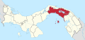
Chepo District Chimán District Panamá District San Miguelito District Taboga District
 Panama
[1]
(2010)[1]
Pacora is a town and corregimiento in Panamá District, Panamá Province, Panama located near Tocumen International Airport.
It is regarded as the industrial area of Panama where many multinationals are moving into for their logistics and industrial hub.[2][3] More than 250 multinationals from manufacturing to IT services are moving there.[4]
References
- ^ a b "Cuadro 11 (Superficie, población y densidad de población en la República...)" [Table 11 (Area, population, and population density in the Republic...)] (.xls). In "Resultados Finales Básicos" [Basic Final Results] (in Spanish). National Institute of Statistics and Census of Panama. Retrieved May 26, 2015.
- ^ http://www.mici.gob.pa/detalle.php?cid=20&id=4953[dead link]
- ^ "Consejo aprueba crear zona franca en Pacora".
- ^ www.presidencia.gob.pa https://www.presidencia.gob.pa/en/News/Government-backs-Free-Trade-Zone-in-the-corregimiento-of-Pacora-that-will-generate-6-thousand-jobs. Retrieved 2023-12-28.
{{cite web}}: Missing or empty|title=(help)
- v
- t
- e
Capital: Panama
- San Miguel
- La Ensenada
- La Esmeralda
- La Guinea
- Pedro González
- Saboga

- Chepo
- Cañita
- Chepillo
- El Llano
- Las Margaritas
- Santa Cruz de Chinina
- Madungandí
- Tortí
- Chimán
- Brujas
- Gonzalo Vásquez
- Pásiga
- Unión Santeña
This article about the geography of Panamá Province is a stub. You can help Wikipedia by expanding it. |
- v
- t
- e


 Pacora