Paulson, Manitoba
Place in Manitoba, Canada
51°6′55″N 99°55′58″W / 51.11528°N 99.93278°W / 51.11528; -99.93278[1][2]
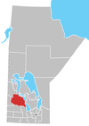
Paulson is a locality in Manitoba, Canada.[1] It is located 9 kilometres (6 mi) southeast of Dauphin and 186 miles (299 km) northwest of Winnipeg.
Paulson lies within the Rural Municipality of Dauphin.
Royal Canadian Air Force
RCAF Station Paulson was the site of British Commonwealth Air Training Plan No. 7 Bombing & Gunnery School during World War II.[3]
References
- ^ a b "Paulson". Geographical Names Data Base. Natural Resources Canada. Retrieved June 13, 2012.
- ^ At geographic coordinates, per Google Earth
- ^ Hatch, F. J. (1983). The Aerodrome of Democracy: Canada and the British Commonwealth Air Training Plan, 1939-1945 (PDF). Ottawa: Directorate of History, Department of National Defence. p. 205. ISBN 0-660-11443-7. Archived from the original (PDF) on February 11, 2014. Retrieved June 2, 2019.
- v
- t
- e
| Former towns |
|---|
| Former villages |
|---|
| Former RMs |
|---|
- Ebb and Flow
- Keeseekoowenin (Partly)
- Alonsa
- Amaranth
- Ashville
- Bacon Ridge
- Bluff Creek
- Cayer
- East Bay
- Eddystone
- Fork River
- Freedale
- Garland
- Glencairn
- Halicz
- Harcus
- Keld
- Kinosota
- Laurier
- Lonely Lake
- Magnet
- Makinak
- Manitoba House
- Meharry
- Million
- Mink Creek
- Moore Dale
- Moose Bay
- Norgate
- North Junction
- Oak Brae
- Ochre River
- Paulson
- Portia
- Reedy Creek
- Reeve
- Reykjavik
- Rorketon
- Ste. Amélie
- Shergrove
- Sifton
- Silver Ridge
- Toutes Aides
- Trembowla
- Valley River
- Valpoy
- Venlaw
- Volga
- Weiden
- Zoria


